


Attention
This website is best viewed in portrait mode.
Vision based terrain mapping and visualization
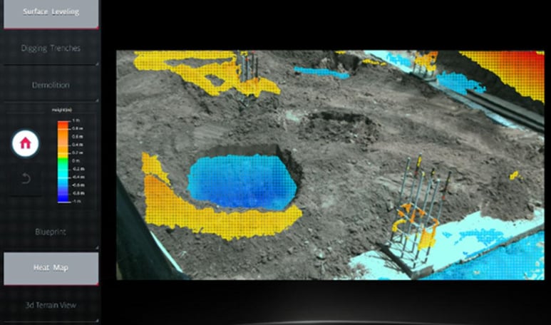
The Vision-based terrain mapping visualization feature uses the 3D terrain mapping technology to assist the operator in deciding/ managing the machine operations such as choosing the task to be done, monitor its progress and validate the job completion. The feature could be enhanced to assign, monitor and manage these tasks from a remote location.